RIVERSIDE, Calif., Sept. 17, 2014 /PRNewswire/ -- The U. S. Department of Agriculture/U.S. Forest Service, in collaboration with San Diego Gas & Electric (SDG&E) and UCLA, today unveiled a new web-based tool to classify the fire threat potential of a weather phenomenon unique to Southern California – the powerful, hot, dry Santa Ana winds that can turn a spark into an inferno.
The Santa Ana Wildfire Threat Index, which includes four classification levels from "Marginal" to "Extreme," will be used to help fire agencies, other first-responders and the public determine the appropriate actions to take based on the likelihood of a catastrophic wildfire fueled by high winds.
"Given the current state of fuel conditions, we have the potential to see devastating fires this fall should significant Santa Ana winds occur," said Forest Service Meteorologist Tom Rolinski. "This tool will directly benefit fire agencies by allowing us to better anticipate what kinds of resources may be needed, as well as where and when we could face the greatest challenges."
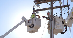
Since the 2007 wildfires in San Diego County, SDG&E has been a partner in enhancing local fire preparedness and has taken major steps to strengthen its overhead electrical system – changing out wooden power poles for steel – to make the grid more wind- and fire-resistant. The utility also hired in-house meteorologists and installed 150 weather stations across its service area to gather real-time information about the impact of weather on utility equipment – all to improve situational awareness during emergencies.
SDG&E's Dave Geier, vice president of electric transmission and system engineering, considered other ways to leverage this significant amount of weather data and to share it broadly.
"I asked my team to come up with something similar to the categories to rate hurricanes that could be used to classify Santa Ana wind events based on their potential to spread a major fire, which would help us in making operational decisions to protect our system and our customers," said Geier. "The goal was to develop a uniform and recognizable system that also could be used to alert fire agencies and communities in time to prepare and take appropriate action."
As luck would have it, Rolinski already had been working on a similar concept and was eager to share ideas and information. Initially, SDG&E's meteorologists compiled hourly weather data for the last 30 years in Southern California – information that was used as a basis for the models that eventually led to the four-level wildfire threat index. The utility reached out to regional fire agencies, including the Forest Service and CAL FIRE, along with universities in Southern California, to partner in the development of the index. SDG&E also provided funding for state-of-the-art computing hardware and software to help turn the raw data into a manageable tool.
The actual "number crunching" was done by a team from UCLA, led by Dr. Robert Fovell, Ph.D., chair of the university's Department of Atmospheric and Oceanic Sciences, who applauded SDG&E's weather network for "its unprecedented station density and uniformity."
"We not only have a new, deeper understanding of how the San Diego-area terrain influences weather, especially wind, which is crucial to SDG&E's operations, but we also have been able to make improvements in weather modeling that will benefit forecasters worldwide," said Dr. Fovell.
The threat index includes four levels of increasingly severe fire potential:
- "Marginal" (yellow) - Upon ignition, fires may grow rapidly.
- "Moderate" (orange) - Upon ignition, fires will grow rapidly and will be difficult to control.
- "High" (red) - Upon ignition, fires will grow very rapidly, will burn intensely, and will be very difficult to control.
- "Extreme" (purple) - Upon ignition, fires will have explosive growth, will burn very intensely, and will be uncontrollable.
The National Weather Service (NWS) is the agency that issues a Red Flag Warning when weather conditions indicate the development of a strong Santa Ana. Forecasters look at fuel moisture, humidity levels, temperature and topography, as well as wind speed, to determine whether to declare a Red Flag Warning, which typically means high fire danger with increased probability of a quickly spreading vegetation fire in the area within 24 hours.
"This index will help forecasters to quantify a Red Flag Warning and the public to better understand the risk," said Roger Pierce, director of the NWS in San Diego. "We believe this new tool will support and complement our forecasts and provide even more information to help the public to be better prepared."
The Santa Ana Wildfire Threat Index is intended to be used by fire agencies, emergency responders, the media and the public. The Forest Service "owns" the tool and is the agency responsible for determining and issuing the alerts, which can be found on the agency's website.
"Each of the levels includes recommended 'calls to action' that escalate as the chance of a catastrophic fire becomes more likely," said Rolinski.
Recommended actions for the public include closely monitoring fire conditions, making sure cell phones are charged and vehicle gas tanks are full, as well as reviewing emergency evacuation plans at work and at home and registering phones to receive reverse-911 warnings for the latest information about an emergency.
U.S. Forest Service
The mission of the U.S. Forest Service, an agency of the U.S. Department of Agriculture, is to sustain the health, diversity and productivity of the nation's forests and grasslands to meet the needs of present and future generations. The agency manages 193 million acres of public land, provides assistance to state and private landowners and maintains the largest forestry research organization in the world. Public lands the Forest Service manages contribute more than $13 billion to the economy each year through visitor spending alone. Those same lands provide 20 percent of the nation's clean water supply, a value estimated at $7.2 billion per year. The agency also has either a direct or indirect role in stewardship of about 80 percent of the 850 million forested acres within the U.S., of which 100 million acres are urban forests where most Americans live.
San Diego Gas & Electric
SDG&E is a regulated public utility that provides safe and reliable energy service to 3.4 million consumers through 1.4 million electric meters and 861,000 natural gas meters in San Diego and southern Orange counties. The utility's area spans 4,100 square miles. SDG&E is committed to creating ways to help customers save energy and money every day. SDG&E is a subsidiary of Sempra Energy (NYSE: SRE), a Fortune 500 energy services holding company based in San Diego. Connect with SDG&E's Customer Contact Center at 800-411-7343, on Twitter (@SDGE) and Facebook.
UCLA's Department of Atmospheric & Oceanic Sciences
UCLA is California's largest university, with an enrollment of more than 40,000 undergraduate and graduate students. The UCLA College and the university's 11 professional schools feature renowned faculty and offer 337 degree programs and majors. UCLA is a national and international leader in the breadth and quality of its academic, research, health care, cultural, continuing education and athletic programs. Seven alumni and six faculty have been awarded the Nobel Prize.
Logo - http://photos.prnewswire.com/prnh/20110106/MM26476LOGO
SOURCE San Diego Gas & Electric (SDG&E)


Share this article